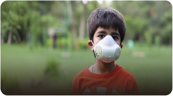
AIR QUALITY MONITORING DRONE
Transforming Environmental Insights Real-time Air Quality Data with Cutting-edge Drone Technology
Industry leaders trust Prana Air to grow their revenue


Drone Category
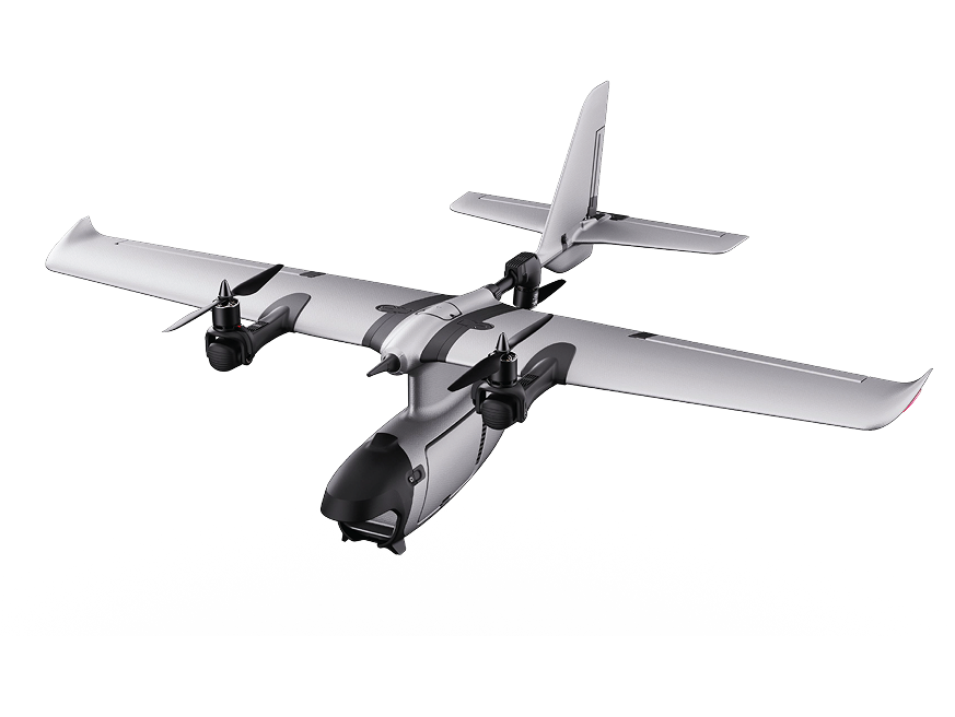
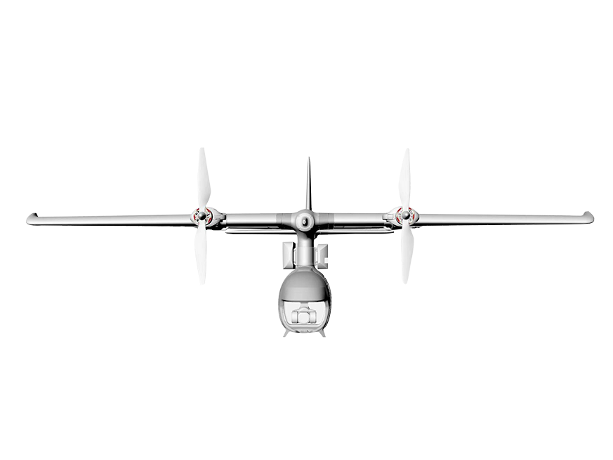
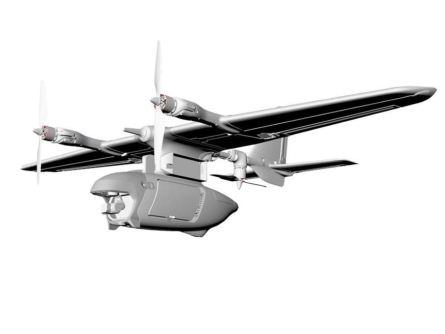
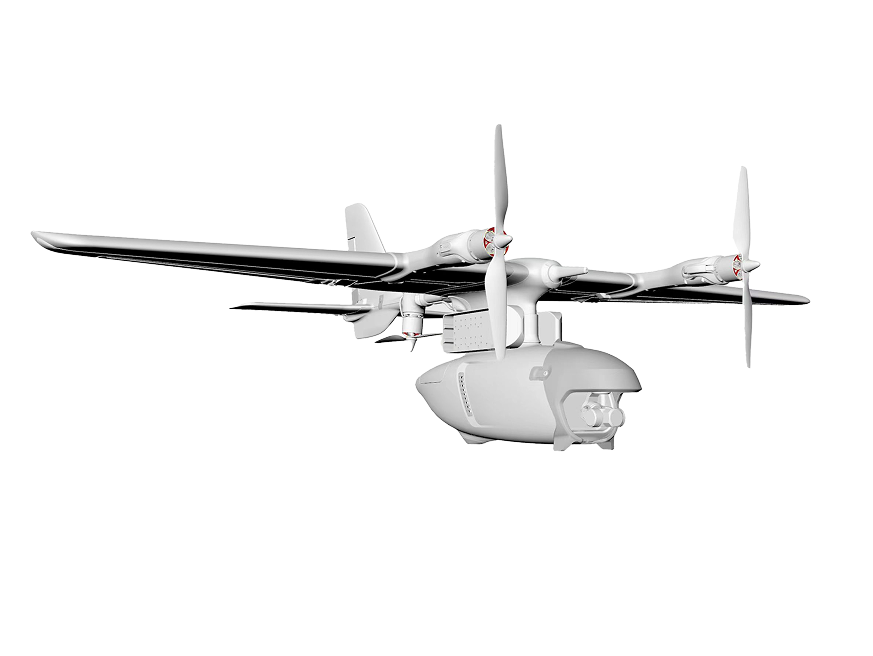
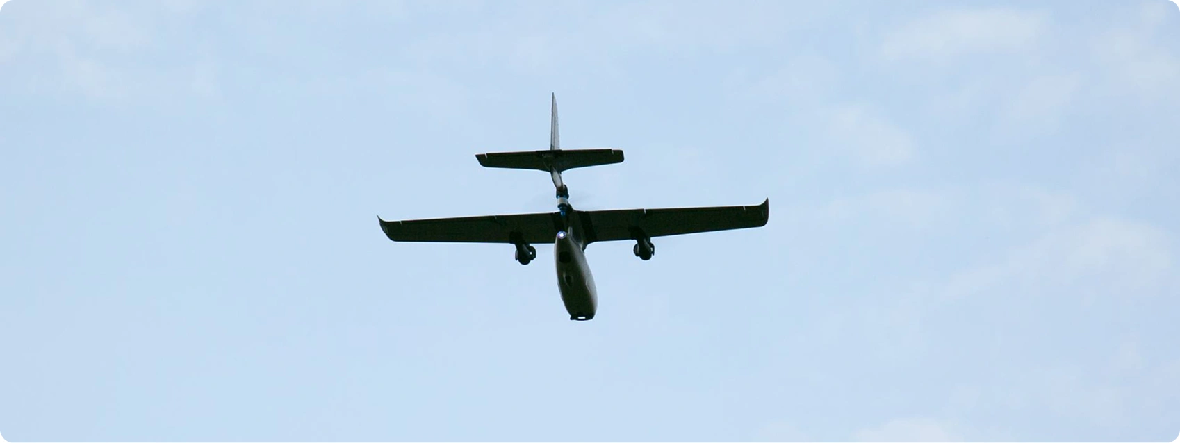
The Prana VTOL (Vertical Takeoff and Landing) is a high-tech fixed-wing FPV drone designed for long-range air quality monitoring. It combines the ability to take off vertically with a long flight range of up to 90 km. This makes it perfect for mapping pollution, checking industrial compliance, and conducting environmental research. With a thermal camera and advanced sensors, it provides real-time data, even in remote or difficult areas.
imaging
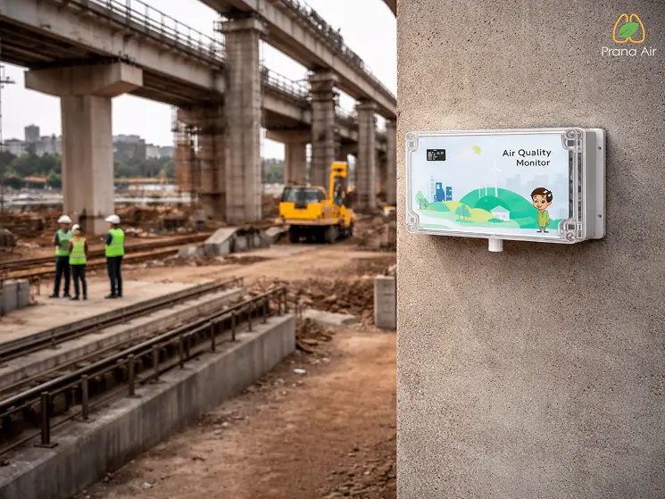
Advanced Air Quality Monitoring Technology
Both drones leverage AI-powered sensor suites to detect and map pollutants, enabling
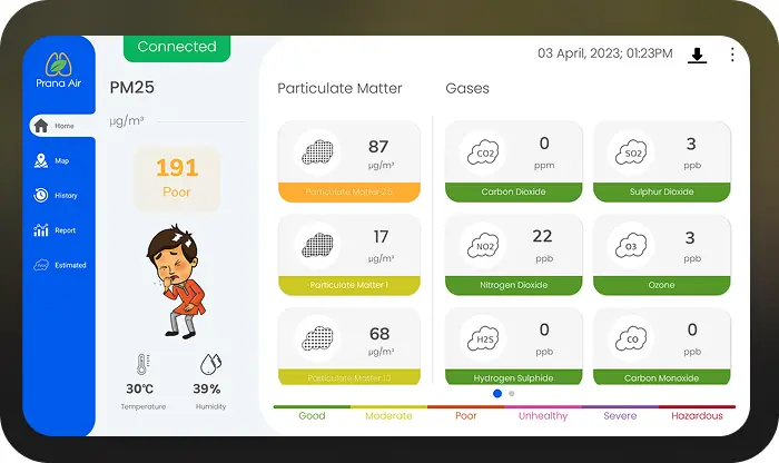
Parameters
Measured PM1
PM1 PM2.5
PM2.5 PM10
PM10 TEMP
TEMP Humid
Humid CH4
CH4 CO
CO H2S
H2S NH3
NH3 NO2
NO2 O3
O3 SO2
SO2
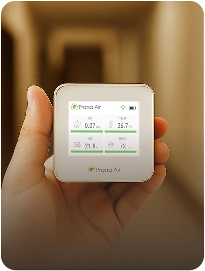
Data Insights from Controller or App Connectivity

Real-Time Maps
Visual representation of current air quality data

Historical Data
Analysis of past measurements for trend identification

Graph Generation
Visual graphs for easy interpretation

Data Plotting
Detailed plots for in-depth analysis
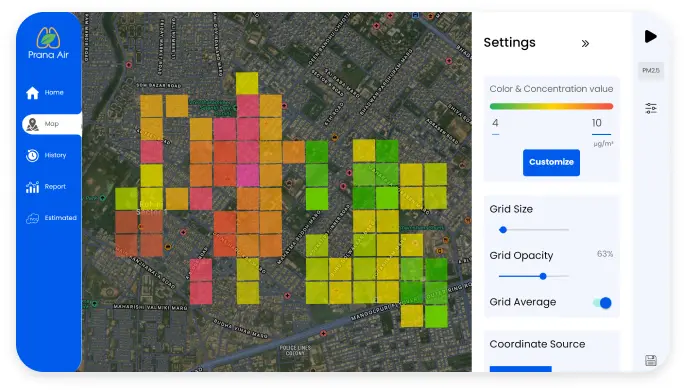
Heat Maps
Colour-coded maps highlighting pollution hotspots
Custom Data
Tailored reports based on user needs
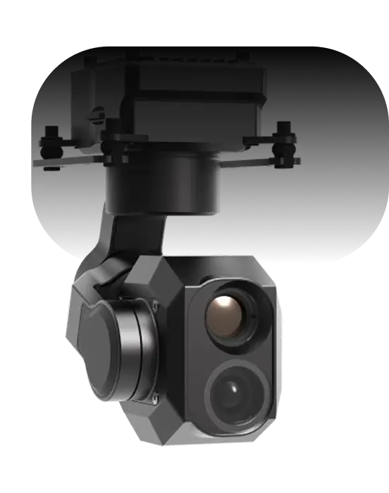
Dual Night vision + Thermal camera
High-resolution camera with GNSS integration for precise geo-tagging.
- AI Object Tracking
- ±0.01° stabilization
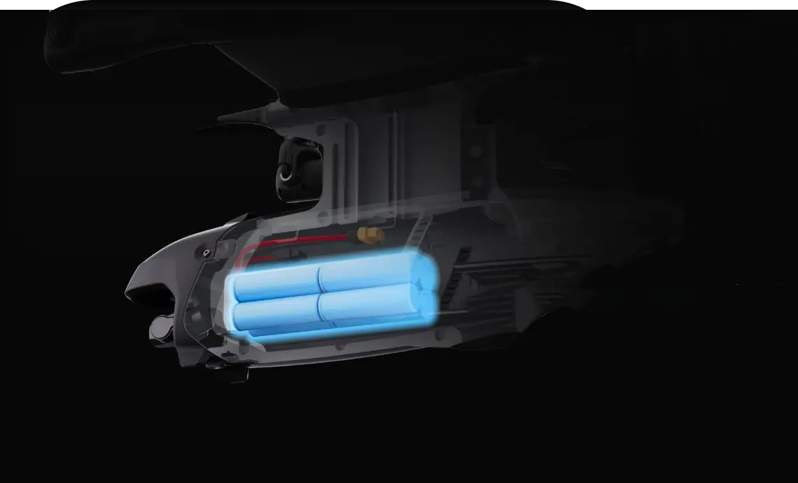
5000 mAh
High capacity Battery
Up to 90km range with 90minute flight time (4SP and 3S Li-ion)
- 4SP
- 3S Li-ion
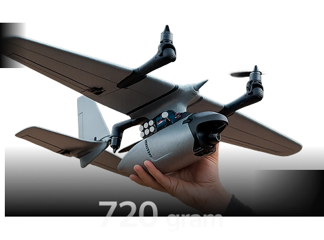
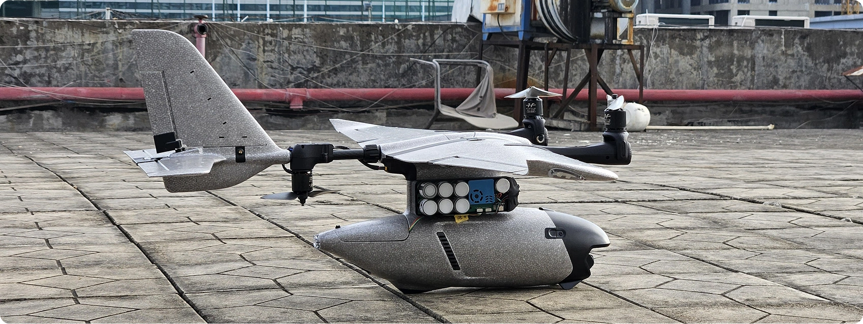
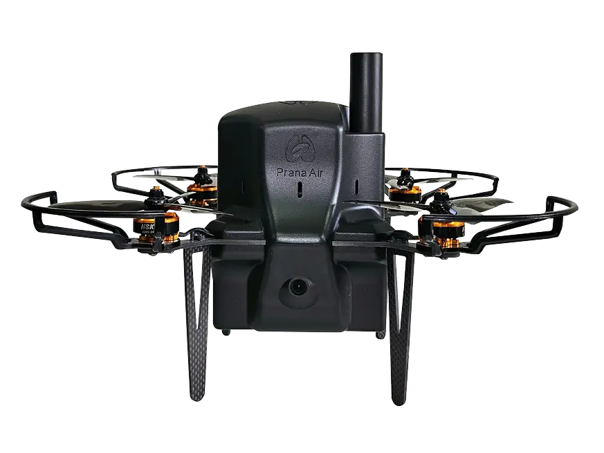
Lightweight Drone for Quick & Easy Air Monitoring
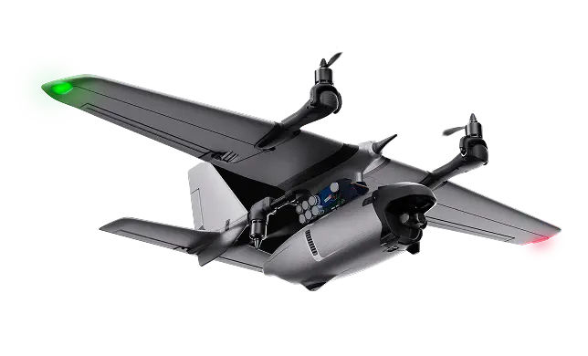
Smallest, fastest Air Quality Drone as Weighing just 720g—perfect for quick pollution checks in cities. it is easy to deploy and manoeuvre, making it perfect for localized pollution tracking.
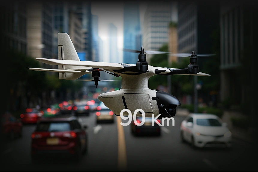
Long-Endurance Drone for Large-Scale Pollution Mapping
Designed for big missions, the Prana Air Drone can fly up to 90 km and stay airborne for long time. As whether monitoring industrial regions or large areas, it ensures maximum coverage with precise air quality insights!
Advanced Air Quality
Monitoring Technology
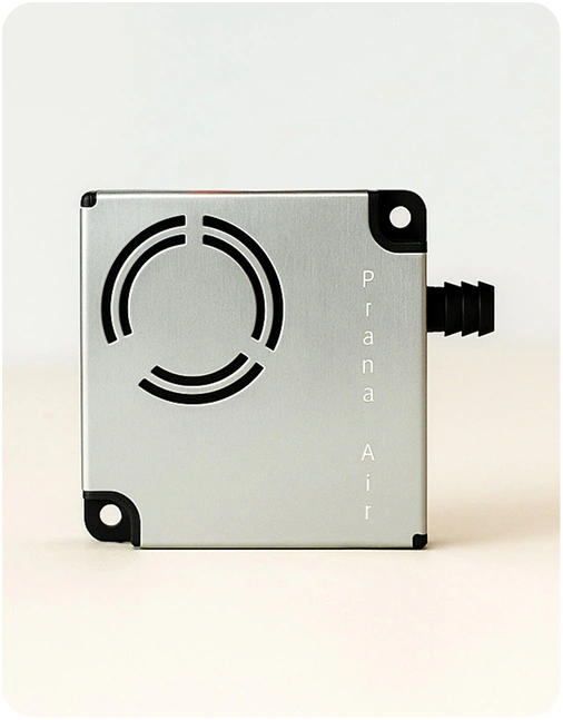
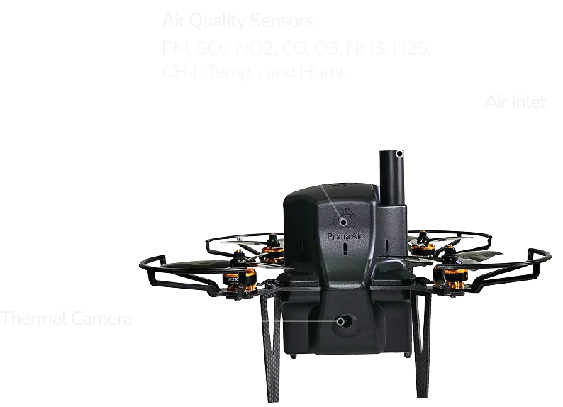
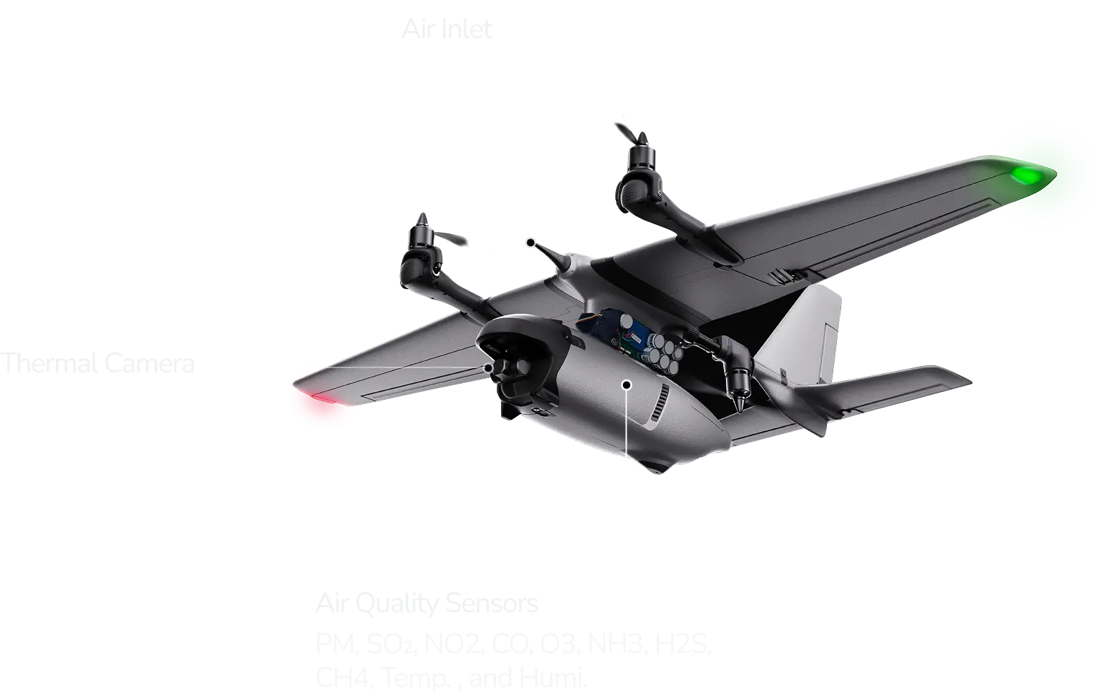
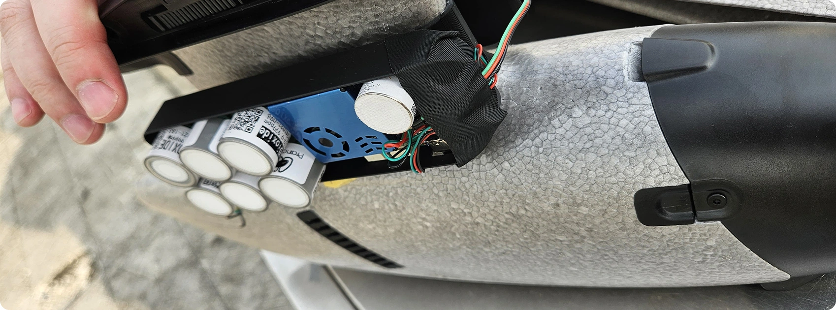
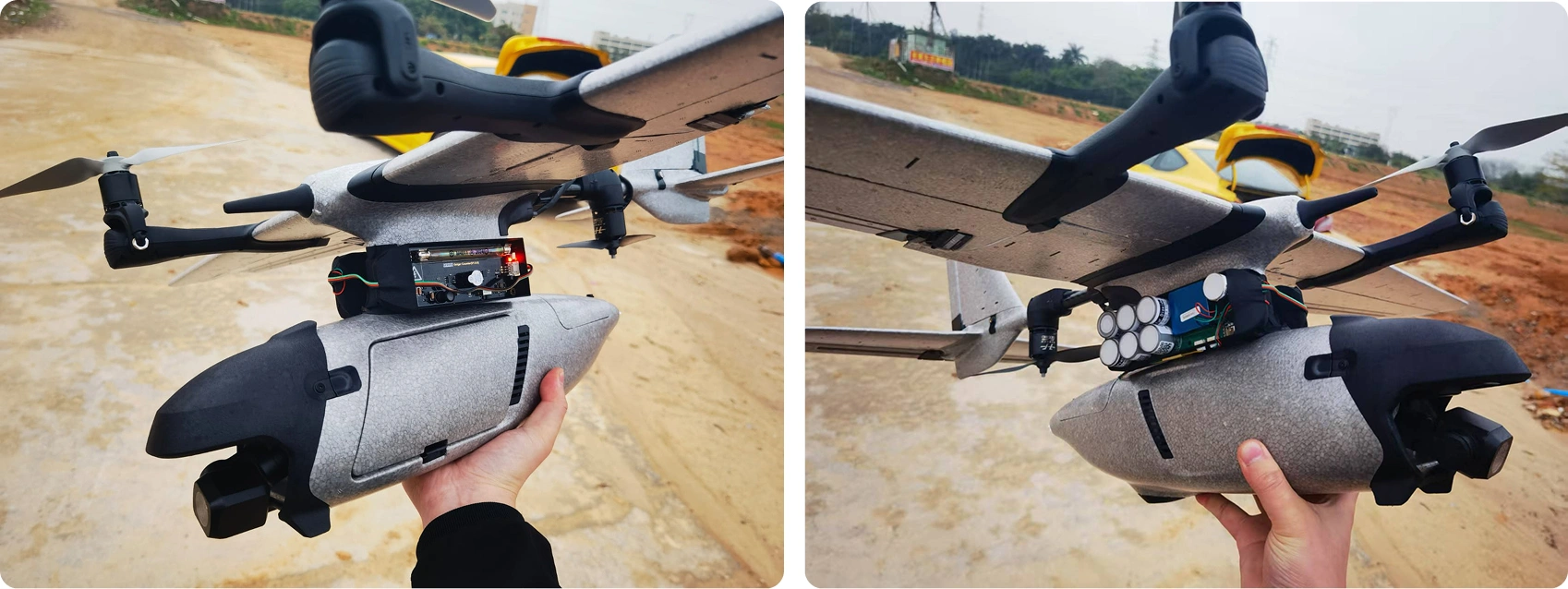
Labelling of Drone
Detailed view of the drone’s sensors and components for accurate air quality monitoring.
Product Gallery

VTOL vs. Quad: Tailored for Your Needs
 Flight Range
 Use Case
 Camera
 Portability
Prana VTOL
90km (long-endurance)
Industrial sites, environmental research
Thermal + 4K night vision
Compact design, 1.8kg max weight
Request a quotePrana QUAD
1km (localized precision)
Urban areas, rapid deployments
High-resolution with GNSS
Ultra-lightweight (720g), 5-inch props
Request a quoteTechnical Specifications
Parameters:
- Breathalyzer
Materials:
- PC+ABS
Working current:
- ≤20mA
Device dimension:
- 66mm X 40mm X 16mm
Parameters:
- Breathalyzer
Materials:
- PC+ABS
Working current:
- ≤20mA
Device dimension:
- 66mm X 40mm X 16mm
Parameters:
- test
Materials:
- PC+ABS
Working current:
- ≤20mA
Device dimension:
- 66mm X 40mm X 16mm
Parameters:
- Breathalyzer
Materials:
- PC+ABS
Working current:
- ≤20mA
Device dimension:
- 66mm X 40mm X 16mm

Contact Info
Looking for Any Air Quality Solution?
Phone:
(+91) 73918-73918
Email:
[email protected]
Office:
Crown Heights, 7th Floor, 706, Sec-10, Rohini, Delhi - 110085, India